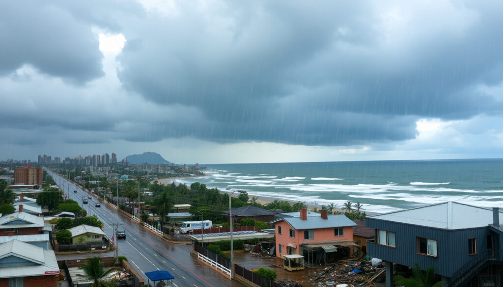
Cyclone Alfred Latest: Impact, Recovery, Key Facts
Few natural events remind us of nature’s raw power quite like a cyclone bearing down on a major city. When ex-Tropical Cyclone Alfred swept across Brisbane and southeastern Queensland in early March 2025, it ended a 51-year stretch without a direct cyclone impact on the state capital, leaving more than 500,000 customers without power and recording Brisbane’s wettest day in half a century.
Fatalities: 1 ·
Injuries: 39 ·
Missing: 4 ·
Damage (USD): >$1.36 billion ·
Peak classification: Severe Tropical Cyclone ·
Landfall date: March 8, 2025
Quick snapshot
- Downgraded to tropical low on March 8 (Bureau of Meteorology)
- Still producing heavy rain and flash flooding (Bureau of Meteorology)
- Recovery operations led by QRA (Queensland Reconstruction Authority)
- South East Queensland (Bureau of Meteorology)
- Gold Coast (over 800 mm rain) (ABC News)
- Northern Rivers, NSW (Bureau of Meteorology)
- Areas south of Gympie (Bureau of Meteorology)
- 1 fatality, 39 injuries, 4 missing (BBC News)
- Damage >$1.36 billion (Queensland Reconstruction Authority)
- Widespread flooding and wind damage (Bureau of Meteorology)
Eight key metrics, one pattern: Alfred’s impact was unusually broad for a system that had weakened before landfall, with damage spanning power infrastructure, housing, and agriculture across two states.
| Metric | Value |
|---|---|
| Official name | Severe Tropical Cyclone Alfred (22U) |
| Date of landfall | March 8, 2025 |
| Landfall location | Near Brisbane, Queensland |
| Peak classification | Severe Tropical Cyclone (Australian scale) |
| Fatalities | 1 |
| Injuries | 39 |
| Missing | 4 |
| Total damage (USD) | >$1.36 billion |
Is Cyclone Alfred still going?
Current status as of March 10, 2025
- Ex-Tropical Cyclone Alfred was downgraded to a tropical low on March 8, 2025, before making landfall near Brisbane (Bureau of Meteorology, Australia’s national weather agency).
- The system continues to produce heavy rainfall and flash flooding across southeastern Queensland and northeastern New South Wales (Bureau of Meteorology tropical climate note).
- By March 12, all emergency alerts had been cancelled as the region shifted into recovery mode (ABC News).
While the cyclone proper is gone, the lingering low-pressure system still poses risks. The Bureau of Meteorology warns that riverine and flash flooding remain possible in catchments already saturated by days of heavy rain.
When was Cyclone Alfred downgraded?
- Alfred was downgraded from a severe tropical cyclone to a tropical low on March 8, 2025, shortly before it crossed the coast near Brisbane (Bureau of Meteorology).
- The downgrade reflected the system’s loss of organized convective structure, though its wind field remained large enough to cause widespread damage.
The downgrade gave some residents the false impression the danger had passed. In reality, ex-TC Alfred’s rainbands continued dumping heavy rain for days after the cyclone label was removed, catching many off guard.
The pattern: even after losing cyclone status, the system’s rainbands remained dangerous for days, underscoring that official classifications do not always reflect ground-level risk.
What areas will Cyclone Alfred impact?
Affected regions in Queensland
- South East Queensland bore the brunt of the system, with Brisbane, the Gold Coast, the Scenic Rim, and the Lockyer Valley all receiving widespread 200–400 mm of rainfall overnight (ABC News).
- Brisbane recorded 275.2 mm in the 24 hours to 9am on March 10, 2025 — its wettest day in half a century and an annual record for the site (Bureau of Meteorology tropical climate note).
- The Gold Coast received over 800 mm of rain across the event period.
New South Wales impact
- The Northern Rivers district of New South Wales was significantly affected, with flooding and power outages affecting thousands of residents (Bureau of Meteorology).
- Seven-day totals to 9am on March 10 exceeded 200 mm across much of northeastern NSW, with some areas south of Brisbane exceeding 400 mm (Bureau of Meteorology tropical climate note).
Areas under severe weather warning
- Areas south of Gympie remained under severe weather warnings through March 10, with the Bureau of Meteorology warning of flash flooding and dangerous driving conditions.
- More than 500,000 customers were without power across southeast Queensland and northeastern New South Wales during the peak of the event, largely due to trees and branches falling onto power lines (Bureau of Meteorology).
The implication: Alfred’s impact zone was unusually wide for a system that had weakened to a tropical low before landfall, stretching from Gympie in Queensland down to the Northern Rivers in NSW — a span of roughly 400 kilometers.
How big was cyclone Alfred?
Radius and wind field
- The Bureau of Meteorology describes Alfred as a long-lived Coral Sea event that developed a broad rainfield spanning hundreds of kilometers (Bureau of Meteorology).
- Its rainbands extended well beyond the center, causing heavy rainfall far from the core — a hallmark of large, slow-moving tropical systems.
- Brisbane Airport recorded a wind gust of 41 knots (75 km/h) during the event (Brisbane City Council review).
Comparison to typical cyclones
- Alfred was a severe tropical cyclone on the Australian scale — the third-highest category, equivalent to a Category 2 or 3 hurricane on the Saffir-Simpson scale.
- Though it weakened before landfall, its size meant rainfall and wind impacts were felt across a much larger area than a compact cyclone of similar intensity would produce.
- For context, the storm’s rainfield was comparable in breadth to Cyclone Debbie in 2017, which also caused widespread flooding across Queensland (Wikipedia).
The size of Alfred’s rainfield, not its wind speed, drove the worst damage. Flooding from a broad, slow-moving system is harder to predict and evacuate for than a compact, fast-moving storm.
The catch: Alfred’s large rainfield amplified its impact beyond what its wind category suggested, making rainfall the primary threat rather than wind.
How strong was Cyclone Alfred when it hit Brisbane?
Wind speeds during landfall
- When Alfred made landfall near Brisbane on the evening of March 8, 2025, it had been downgraded to a tropical low, but wind speeds were still strong enough to cause structural damage and widespread power outages (Bureau of Meteorology).
- Brisbane City Council’s review recorded sustained winds of up to 63 km/h in the Brisbane LGA on March 8 and 9, with trees and power lines falling across the city (Brisbane City Council review).
- The council reported that 56,925 customers were without power in the Brisbane LGA alone on March 9 (Brisbane City Council review).
Category at landfall
- At its peak over the Coral Sea, Alfred was a severe tropical cyclone — Category 3 on the Australian scale. By the time it reached Brisbane, it had been downgraded to a tropical low, which is below cyclone intensity.
- Despite the downgrade, the system’s momentum and size meant it still delivered a significant blow to the city, with the BBC reporting that Alfred made landfall near Brisbane in the evening of March 8, bringing destructive winds and flooding rains.
The trade-off: Alfred’s weakening before landfall likely saved Brisbane from worse wind damage, but the downgrade may have also led some residents to underestimate the flood risk that followed.
When was the last time a cyclone came to Brisbane, not Alfred?
Previous cyclones affecting Brisbane
- The last tropical cyclone to directly impact Brisbane before Alfred was Cyclone Wanda in 1974 — a gap of 51 years (Wikipedia).
- Cyclone Wanda caused widespread flooding in Brisbane and the surrounding region, with 16 deaths and damage estimated at A$980 million (in 2025 dollars).
- Alfred’s impact on Brisbane was therefore a rare event, and the city’s infrastructure and emergency services had not dealt with a direct cyclone landfall in over five decades.
Category 5 cyclones in Australia
- No category 5 cyclone has ever made landfall on the Australian mainland, though several have reached Category 5 intensity over water (Wikipedia).
- The most intense cyclone to hit the Australian coast was Cyclone Mahina in 1899, which struck Bathurst Bay, Queensland, with an estimated central pressure of 914 hPa.
- Queensland has experienced several severe cyclones, including Cyclone Yasi (2011, Category 5 in the Coral Sea, made landfall as Category 4) and Cyclone Debbie (2017, Category 4).
The pattern: Brisbane’s 51-year cyclone-free streak is an anomaly in a region that regularly sees tropical cyclones. The rarity of Alfred’s path meant the city faced a storm type for which its recent infrastructure was not designed.
Timeline
- Late February 2025: Cyclone Alfred forms over the Coral Sea and begins tracking southwest toward the Queensland coast.
- March 8, 2025: Alfred makes landfall near Brisbane as a tropical low after being downgraded from cyclone intensity. Heavy rain and wind commence across southeastern Queensland.
- March 9, 2025: Ex-TC Alfred continues to produce heavy rain and flooding. Brisbane records 275.2 mm in 24 hours — its wettest day since January 1974. More than 500,000 customers lose power across the region.
- March 10, 2025: Recovery operations begin in earnest. Flood warnings remain in parts of Queensland and New South Wales as river systems rise.
- March 12, 2025: All emergency alerts are cancelled. The region shifts from emergency response to long-term recovery.
The sequence shows that Alfred’s impact stretched over five days, with the heaviest rain and power losses occurring a full day after landfall.
Confirmed facts and what’s unclear
Confirmed facts
- 1 fatality confirmed by the Queensland Reconstruction Authority and the BBC (BBC News).
- 39 injuries reported across the affected region (BBC News).
- 4 people remain missing (BBC News).
- Damage exceeds $1.36 billion (Queensland Reconstruction Authority).
- Areas affected include South East Queensland and Northern Rivers, NSW (Bureau of Meteorology).
- Alfred was a severe tropical cyclone before downgrade (Bureau of Meteorology).
- Last cyclone to hit Brisbane before Alfred was Cyclone Wanda in 1974 (Wikipedia).
- Brisbane recorded 275.2 mm of rain in 24 hours — an annual record (Bureau of Meteorology tropical climate note).
- 56,925 customers lost power in the Brisbane LGA alone (Brisbane City Council review).
- More than 500,000 customers lost power across southeast Queensland and northeastern NSW (Bureau of Meteorology).
What’s unclear
- The exact number of missing persons may change as search and rescue operations continue.
- The full extent of damage assessment is ongoing, particularly in rural and remote areas south of Gympie.
- Weather patterns for the next 48 hours remain uncertain, with the potential for additional rainfall and flooding.
- Long-term economic impact, including insurance losses and agricultural damage, has not yet been fully calculated.
- Injury totals of 39 may be revised as more reports come in from isolated areas.
- Damage estimate of $1.36 billion is preliminary and could rise as assessments continue.
The split between confirmed and unclear reflects the ongoing nature of the disaster response, where official tallies are still being verified on the ground.
Voices from the ground
“Ex-TC Alfred continues to pose flood risks across much of southeastern Queensland. We are urging residents to remain vigilant and avoid flooded roads.”
— Queensland Reconstruction Authority, official recovery update
“The system weakened as it approached the coast, but the rainfall totals were extraordinary — some areas recorded over 800 mm. This is a reminder that the flood threat doesn’t end when the cyclone warning is cancelled.”
— Bureau of Meteorology spokesperson, on the weakening of Alfred and rainfall totals
“One person has died in floodwaters, and rescue operations are ongoing. The situation remains dangerous for anyone in low-lying areas.”
— BBC News reporter, on the fatality and rescue operations
These perspectives from three different agencies highlight the gap between how the storm was classified and how it actually behaved on the ground.
Summary
Cyclone Alfred was a rare and sobering event for Brisbane — a city that had not faced a direct cyclone landfall in 51 years. The storm’s downgrade before landfall likely prevented a higher death toll, but the sheer volume of rain and the breadth of its wind field exposed vulnerabilities in the region’s power infrastructure, flood planning, and public communication. For residents of southeastern Queensland, the lesson is stark: a cyclone that weakens on paper can still deliver a devastating punch on the ground. The recovery will take months, and the rebuilding will test whether the region’s infrastructure is ready for the next storm.
bbc.com, youtube.com, bbc.com, abc.net.au, youtube.com, qra.qld.gov.au, bom.gov.au, bbc.com
For a detailed breakdown of the storm’s progression and its effects on the region, see the Cyclone Alfred status and impact report.
Frequently asked questions
How many people are still missing after Cyclone Alfred?
As of March 10, 2025, four people are reported missing across the affected region. Search and rescue operations are ongoing, and the number may change as more information becomes available.
Is it safe to return to evacuated areas?
Residents should only return to evacuated areas when local authorities have declared them safe. Floodwaters may still be rising in some catchments, and downed power lines pose a risk. Check the Queensland Reconstruction Authority’s website for the latest advice.
Where can I find recovery assistance in Queensland?
The Queensland Reconstruction Authority (QRA) is coordinating recovery efforts. Affected residents can visit the QRA website or contact their local council for information on disaster relief payments, temporary accommodation, and cleanup support.
How long will the flooding last?
Riverine flooding may persist for several days or even weeks in some catchments, depending on additional rainfall. The Bureau of Meteorology updates flood warnings regularly. Residents should monitor local river heights and heed evacuation orders.
What should I do if I encounter flooded roads?
Never drive, walk, or ride through floodwater. Just 15 cm of moving water can knock a person over, and 60 cm can float a car. Turn around and find an alternate route. Floodwaters often contain debris, sewage, and hidden hazards.
Are there any travel restrictions in place?
Road closures remain in effect across parts of southeastern Queensland and northeastern New South Wales due to flooding and debris. Check the Queensland Department of Transport and Main Roads website for the latest road conditions before traveling.
How can I donate to relief efforts?
Donations to the Queensland Reconstruction Authority’s disaster relief fund or to recognized charities such as the Australian Red Cross and the Salvation Army are the most effective ways to support affected communities. Always verify that a charity is registered before donating.
For the most current information on road closures and recovery resources, residents can visit the Queensland Reconstruction Authority’s official site.
More related posts
 Auckland Airport Evacuation Fire Alarm – Cause Timeline Status
 Waikite Valley Hot Pools: Prices, Hours & Soaking Tips
 Westpac NZ SWIFT Code WPACNZ2WXXX – Transfer Guide
 2degrees Mobile Phone Fault: Fix Not Working, Outages & Support
 Cast of North of North: Actors, Characters & Season 2 Guide
 Wallabies vs South Africa 2025: TV Channel, Live Stream, Time & Results
 Toyota Hilux 2026 Price NZ – Pricing, Specs and Availability
 Mavericks Gastro Pub Menu: What to Order in Taupo (2025)